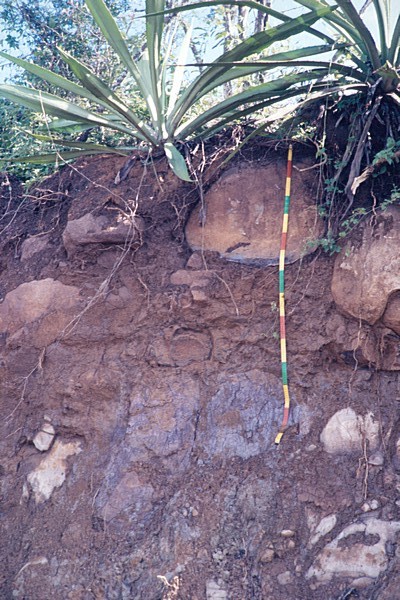
| Ah 0-10 cm |
dark reddish brown (5YR 3/2, moist), clay, moderate fine and medium subangular blocky and moderate fine and medium granular, highly very friable sticky plastic, many medium interstitial pores, few medium gravel strongly weathered basalt fragments, clear smooth boundary to, |
| BA 10-30 cm |
dark reddish brown (5YR 3/4, moist), clay, strong medium and coarse angular blocky, friable sticky plastic, broken moderately thick pressure cutans, common very fine tubular pores, few medium gravel strongly weathered basalt fragments, clear wavy boundary to, |
| Bt 30-67 cm |
yellowish red (5YR 4/6, moist), clay, strong coarse angular blocky, friable sticky plastic, common fine to coarse prominent mottles, common very fine tubular pores, few medium gravel strongly weathered basalt fragments, abrupt wavy boundary to, |
| C 67-150 cm |
red (7.5R 5/6, moist), sandy clay loam, moderately coherent porous massive, few very fine tubular pores, many medium gravel strongly weathered basalt fragments |