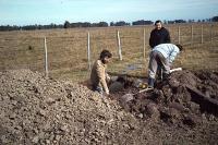
Reference soil Uruguay 01: Planosol
Land form: Many small silted-in fossil streams and scattered small ponded spots.
Micro relief: Small heigth difference of 10-20 cm over distances of a few metres.
Morphology: Ah In lower part of horizon the structure is thick platy. C Also continuous thick clay cutans and very few medium hard angular gypsum nodules observed.
Description: A deep, fine textured and poorly drained soil, with clear horizon differentiation, partly due to the textural change from the loamy topsoil to the clay subsoil. The soil is relatively low in organic matter (the amount of which decreases gradually with depth) while the pH increases from strong (5,5) in the topsoil to slight acidity (6,4). Mottiling mainly occurs in the topsoil (A and E horizons) and in the upper part of the B horizon. Iron-mangenese nodules occur throughout the profile (frequency increases with dept) down to the B3 horizon, below which only very few nodules occur.
Thornthwaite Waterbalance for the profile: Months: J F M A M J J A S O N D P 90 80 100 95 90 110 85 100 100 90 65 65 PE 146 113 93 57 32 21 24 38 46 89 123 148 P-PE -56 -33 7 38 58 89 61 62 54 1 -58 -83 APWL 197 230 200 101 15 0 0 0 0 0 58 141 ST 40 32 39 77 135 150 150 150 150 150 101 58 DST -18 -8 -7 38 15 0 0 0 0 0 -49 -43 AE 108 88 93 57 32 21 24 38 46 89 114 108 D . . 74 61 62 54 1 S 38 25 . . . . . . . . 9 40 P = precipitation (mm) PE = potential evapotranspiration (thorntwaite) (mm) P-PE = precipitation deficit (mm) APWL = accumulated precipitation deficit (mm) ST = available moisture in the rooted zone (mm) available moisture at field capacity is 150 mm DST = change in available moisture (mm) D = moisture deficit (mm) S = moisture surplus (mm) LITERATURE: Angueira, C. (1983) Environmental settin and characteristics of an eutric planosol of the merin lagoon areao of Uruguay - Brasil (part of a ISM Soil Monolith Paper). MSc Thesis. Dept. of Soil Science and Geology, Wageningen Agricultural University. Ministerio de Ganaderia y Agricultura Uruguay (1972) Estudio de Suelos, Area Yaguaron - Depto, Cerro Largo Merin Lagoon Regional Project (CLM/PNUD/FAO) (1969) Studies in the Merin Lagoon Basin.
|
WRB 2006: |
WRB 1998: |
||||||||||||||||||||
|
|
||||||||||||||||||||
|
|
|
FAO-UNESCO-ISRIC 1988: |
FAO-UNESCO 1974: |
||||||||||||||||||||
|
|
||||||||||||||||||||
|
|
Other classification
|
USDA-NRCS (1999) |
Typic | Albaqualf |
|
USDA-SCS (1975) |
Typic | Albaqualf | fine-loamy | mixed | thermic |
|
Classification (other) |
Planosol districo ocrico Fr |
| The colour-requirements for stagnic properties are not met. Lack of textural data: abrubt textural change assumed. |
Departamento Cerro Largo, 10km S of Rio Branco, Jaguaron area
