Reference soil Italy 01: Cambisol
Cambisols occur mainly in the temperate and boreal regions of the world, where the soil’s parent material is still young or where low temperatures slow down the processes of soil formation.
Characteristics
Soils having either a cambic horizon (a horizon showing evidence of alteration with respect to the underlying material), or a mollic horizon overlying a subsoil, which has a base saturation of less than 50 percent in some part within 100 cm from the soil surface, or one of the following diagnostic horizons within the specified depth: an andic, vertic, or vitric horizon starting between 25 and 100 cm; a (petro-)plinthic or salic horizon starting between 50 and 100 cm, in absence of loamy sand or coarser textures above these horizons.
Reference soil IT001: Cambisols
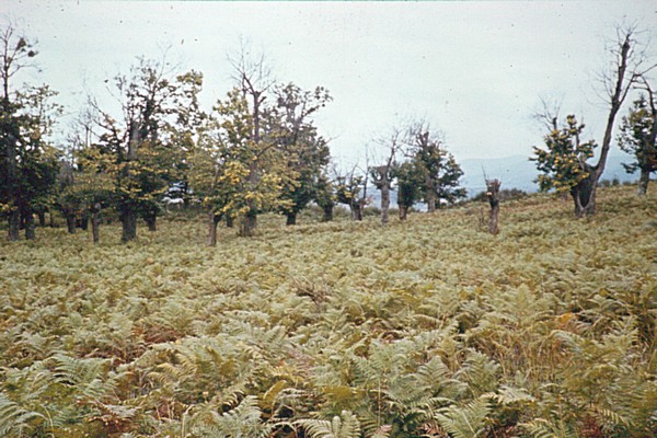
Short field description: A very deep, well drained, brown, loamy soil. A dark brown clay loam (A-horizon) is from 52 cm onwards underlain by a dark reddish silt loam and a silty clay loam. The B3-horizon continues below a depth of 150 cm, colouring reddish brown to yellowish red in the lower part, with a texture of a silty clay. The bulk of the roots is confined to the top 70 cm; moderate to coarse subangular blocky structure is common in the B-horizon. The pH is slightly acid in the upper part of the solum and medium acid in the B3. The top-horizon (0), from 1 to 0 cm consists of partly decomposed organic material. Soils of this kind were encountered in the Upper Crate basin, are however not neccessarily restricted to this region. Precise distribution patterns are not known. These soils are associated with rankers and redder Mediterranean soils. The soils differs from reddish brown soils, developed under similar environment, in lacking an argillic horizon and having a low base saturation percentage. The pH is determined conform Hellige. * The effective soil depth is at least 150 cm, no evidence of groundwater within 2 meters. A detailed description of the vegetation of the East side of the river T.Narigliano (at site)is made. Author: Bos (ITC) date: 05-72 Area: 10 * 10 m Coverage: 95% Trees: Castanea of ca. 15m., very old, hollow trees, coverage of 20% Shrubs: Maximum height of 1.5m., coverage of 10% Herbs: Maximum height of 0.8m., coverage of 90% Trees: Castanea 1 Coverage/sociablilty Shrubs: Rubus1.3+ = 5%1 = loose Cistus salvifolius2.41 = 05-10%2 = small polls Crataegus oxycantra+.12 = 10-25%3 = big polls Rosa sp.+.13 = 25-50%4 = almost covered surface Spartium Junceum14 = 50-75%5 = covered surface Herbs: Pteridium2.35 = 75-100% Cirsium sp.2.1 Thymus sp.2.2 Bellisperenne1.1 Luzula campestre2.1 Carex sp.1.1 Castania1.1 Quercus pubescens1.1 Crepis+.1 "grass"2.2 Dactylus glomerata3.2 Lotium perrene+.2 Dianthus+.1 Viccia sepium2.2 Galium2.3 Ruscus+.2 Hordeum+.1 Trifolium campestre2.2 Trifolium repens2.4 Bryza+.1 Poa sp.+.2 Cynosurus sp.+.2 Lathyrus+.1 "rest"+.1